ITINERARY

Date

Port

Arrive

Depart

JAN 13

WED

MIAMI, FLORIDA

6:00 PM

JAN 14

THU

CRUISING THE BAHAMAS ISLANDS

JAN 15

FRI

CRUISING THE ATLANTIC OCEAN

JAN 16

SAT

GUSTAVIA, ST. BARTS

1:00 PM

8:00 PM

JAN 17

SUN

FORT DE FRANCE, FRANCE

12:00 PM

8:00 PM

JAN 18

MON

ST. GEORGE'S, GRENADA

8:00 AM

7:00 PM

JAN 19

TUE

EL GUAMACHE, VENEZUELA

10:00 AM

6:00 PM

JAN 20

WED

KRALENDIJK BONAIRE, NETHERLANDS

12:00 PM

10:00 PM

JAN 21

THU

ORANJESTAD, ARUBA

7:00 AM

2:00 PM

JAN 22

FRI

CARTAGENA, COLOMBIA

12:00 PM

7:00 PM

JAN 23

SAT

COLON, PANAMA

1:00 PM

11:59 PM

JAN 24

SUN

PANAMA CANAL TRANSIT

JAN 25

MON

CRUSIING THE GULF OF PANAMA

JAN 26

TUE

MANTA, ECUADOR

8:00 AM

6:00 PM

JAN 27

WED

GUAYAQUIL, ECUADOR

8:00 AM

6:00 PM

JAN 28

THU

CRUISING THE COAST OF PERU

JAN 29

FRI

SALAVERRY, PERU

8:00 AM

6:00 PM

JAN 30

SAT

LIMA (CALLAO), PERU

12:00 PM

JAN 31

SUN

LIMA (CALLAO), PERU

6:00 PM

FEB 1

MON

PISCO, PERU

8:00 AM

4:00 PM

FEB 2

TUE

AREQUIPA (MATARANI), PERU

1:00 PM

10:00 PM

FEB 3

WED

IQUIQUE, CHILE

1:00 PM

9:00 PM

FEB 4

THU

CRUISING THE PACIFIC OCEAN

FEB 5

FRI

COQUIMBO, CHILE

1:00 PM

8:00 PM

FEB 6

SAT

VALPARAÍSO, CHILE

9:00 AM

7:00 PM

FEB 7

SUN

CRUISING THE PACIFIC OCEAN

FEB 8

MON

PUERTO MONTT, CHILE

9:00 AM

6:00 PM

FEB 9

TUE

PUERTO CHACABUCO, CHILE

11:00 AM

9:00 PM

FEB 10

WED

CRUISING THE CHILEAN FJORDS & PACIFIC OCEAN

FEB 11

THU

CRUISING THE CHILEAN FJORDS & PACIFIC OCEAN

FEB 12

FRI

PUNTA ARENAS, CHILE

5:30 AM

5:00 PM

FEB 13

SAT

USHUAIA, ARGENTINA

12:00 PM

8:00 PM

FEB 14

SUN

CRUISING THE ATLANTIC OCEAN

FEB 15

MON

PORT STANLEY, FALKLAND ISLANDS

7:00 AM

4:00 PM

FEB 16

TUE

CRUISING THE ATLANTIC OCEAN

FEB 17

WED

CRUISING THE ATLANTIC OCEAN

FEB 18

THU

PUNTA DEL ESTE, URUGUAY

8:00 AM

11:59 PM

FEB 19

FRI

MONTEVIDEO, URUGUAY

2:00 PM

9:00 PM

FEB 20

SAT

BUENOS AIRES, ARGENTINA

10:00 AM

FEB 21

SUN

BUENOS AIRES, ARGENTINA

FEB 22

MON

BUENOS AIRES, ARGENTINA

5:00 PM

FEB 23

TUE

PUNTA DEL ESTE, URUGUAY

8:00 AM

11:59 PM

FEB 24

WED

MONTEVIDEO, URUGUAY

7:00 AM

5:00 PM

FEB 25

THU

RIO GRANDE, BRAZIL

1:00 PM

9:00 PM

FEB 26

FRI

CRUISING THE COAST OF BRAZIL

FEB 27

SAT

PORTO BELO, BRAZIL

8:00 AM

4:00 PM

FEB 28

SUN

SANTOS, BRAZIL

8:00 AM

6:00 PM

FEB 29

MON

ILHA GRANDE, BRAZIL

9:00 AM

6:00 PM

MAR 1

TUE

PARATI, BRAZIL

8:00 AM

5:00 PM

MAR 2

WED

BÚZIOS, BRAZIL

9:00 AM

7:00 PM

MAR 3

THU

RIO DE JANEIRO, BRAZIL

8:00 AM

MAR 4

FRI

RIO DE JANEIRO, BRAZIL

6:00 PM

MAR 5

SAT

CRUISING THE COAST OF BRAZIL

MAR 6

SUN

CRUISING THE COAST OF BRAZIL

MAR 7

MON

RECIFE, BRAZIL

9:00 AM

5:00 PM

MAR 8

TUE

CRUISING THE COAST OF BRAZIL

MAR 9

WED

CRUISING THE COAST OF BRAZIL

MAR 10

THU

MACAPA (AMAZON RIVER), BRAZIL

5:00 PM

6:00 PM

MAR 11

FRI

ALTER DO CHÃO (AMAZON RIVER), BRAZIL

3:00 PM

8:00 PM

MAR 12

SAT

BOCA DA VALERIA (AMAZON RIVER), BRAZIL

8:00 AM

3:00 PM

MAR 13

SUN

MANAUS (AMAZON RIVER), BRAZIL

8:00 AM

MAR 14

MON

MANAUS (AMAZON RIVER), BRAZIL

6:00 PM

MAR 15

TUE

PARINTINS (AMAZON RIVER), BRAZIL

12:00 PM

6:00 PM

MAR 16

WED

SANTARÉM (AMAZON RIVER), BRAZIL

8:00 AM

2:00 PM

MAR 17

THU

MACAPA (AMAZON RIVER), BRAZIL

9:00 AM

10:00 AM

MAR 18

FRI

DEVIL'S ISLAND, FRENCH GUIANA

2:00 PM

7:00 PM

MAR 19

SAT

CRUISING THE ATLANTIC OCEAN

MAR 20

SUN

BRIDGETOWN, BARBADOS

8:00 AM

4:00 PM

MAR 21

MON

ST. JOHN'S, ANTIGUA

10:00 AM

5:00 PM

MAR 22

TUE

SAN JUAN, PUERTO RICO

9:00 AM

5:00 PM

MAR 23

WED

CRUISING THE BAHAMAS ISLANDS AND THE ATLANTIC

MAR 24

THU

NASSAU, BAHAMAS

12:00 PM

7:00 PM

MAR 25

FRI

MIAMI, FLORIDA

7:00 AM


Sunday, January 24, 2016

DAY 12--TRANSITING THE PANAMA CANAL

                                               Our route through Panama today

Historical/Background Info:
        Exciting day as we are transiting the Panama Canal.  This is our 8th time to go through the canal but I will never get bored with it.  People as us all the time what our favorite cruise has been.  This right up there at top of the list!!!  The history and engineering of the canal is remarkable to say the least.  Construction of the canal began in 1904 and was not completed until 1914 at a cost of $352 million dollars.  Hard to say what it would cost today.  Because of landslides it was closed and the formal opening was delayed by WWI until 1920.  The French started to build the canal back in 1880, but after 22,000 laborers died from yellow fever and malaria due to the mosquito’s, they gave up.  The United States stepped in to build it in 1904.  The US controlled and provided the defense for the Panama Canal Zone until 1977 when a gradual hand over to the Panama Canal Authority was completed in 1999.  So now the Panamanian government owns and operates the canal.  (Big mistake in my humble opinion but Jimmy Carter was President then)  The canal currently has a workforce of 9,000 employees and operates 24 hours a day, 365 days a year.  I bet most of you thought the Panama Canal runs East-West.  WRONG!  The canal actually runs North-South.
        We began our transit of the canal at 7:00 this morning.  The first set of locks are the Gatun locks at Limon Bay (Caribbean Sea/Atlantic side of Panama).  The Gatun locks consist of three chambers.  The ship is raised in each lock by water from the chamber above it.  Gravity moves the water to equalize the water levels and the ship rises.  The Gatun locks raise our ship 85 feet above sea level and into Gatun Lake.  This huge lake was formed mostly by damming up the rivers.  The engineers had to make an 8 mile cut through one section which is called, The Gaillard Cut.  Thirty million cubic yards of rock and dirt had to be excavated by steam shovels.   We are sailing 23 miles across Gatun Lake to reach our next lock, called the San Pedro Lock.  Here we will start our descent to sea level on the Pacific side.  The San Pedro chamber will lower us 31 feet and then we will enter Miraflores Lake.  From the San Pedro lock to the final set of locks, the Miraflores Locks, it is only little over a mile.  So basically right back into the Miraflores Locks which consist of 2 chambers that will lower us a total of 54 more feet down to sea level again.  So we went up 85 feet and then down 85 feet.  The total Panama Canal transit is 51 miles and takes between 8 to 10 hours depending on traffic.  Each lock chamber is 110 feet wide and 1050 feet in length which can handle the Panamax size cargo ships.  There are two lanes in each lock so two ships can go through at the same time thus saving water from the lake.  When the gates of the locks open at sea level, 26 million gallons of water from Lake Gatun goes into the ocean and is lost.  This happens on both sides so 52 million gallons of water is used for each transit.  What makes the canal work is all the rain that Panama gets to keep the lake full all the time.  A new lane through the canal is now under construction with larger lock chambers so it will be able to handle the newer and larger cargo ships as well as United State’s aircraft carriers.  They now have to go all the way around South America to get from Atlantic to Pacific oceans.  The estimated cost of the new lane is $5.25 billion and the locks are designed to use 7% less water lost.  The new lane was due to open in 2014 in time to celebrate the 100th anniversary of the canal but is now delayed until April 2016.
By the way, the cost for our ship’s transit today is about $150,000.  Fares size and type of cargo ship but cruise ships pay based on number of passengers.  Each ship’s company has to wire the money to Panama PRIOR to its transit.  No credit cards, thank you!!
        There is a viewing stand at the Miraflores Locks for visitors to come see the ships intransit.  It’s always fun to wave at them as we pass by.  The visitor’s center is only 20 minute taxi ride from Panama City, Panama.  About 30 minutes after exiting the last lock chamber we pass under the Pan American Highway Bridge on north edge of Panama City.  This series of highways is 30,000 miles long and except for a 60 mile gap you could drive from northern Alaska to southern South America.

What We Did Last Night:
                                    Susanne being served some spaghetti by Dennis.

The pieces of veal parm were  huge.  I will have them put more marinara sauce over it before the cheese next time however.  Don't get me wrong, we really enjoyed it.  The fried calamari was also delicious.
                            The folkloric show was indeed very colorful and interesting.

                                            The narrator said this dress costs $25,000.
                                             Photo is of the whole cast after the show.

What We Did Today:
      Two tugs on each side of our ship to get us lined up perfectly for entering the first lock.

                                            I think this will be on tonight's menu.
A large alligator watching us as we were about to enter the lock.  It probably wanted me on his menu.
We entered the first lock this morning at 8:30.  This is good profile of how ships are moved from one ocean to another.


 Now entering the first of the three Gatun locks. The 3 locks will raise us 85 feet to the level of Gatun Lake.
This is called a "mule".  It is an electric locomotive that is used to keep ships centered in the locks.  100 years ago they cost $15,000 but cost now is over $2 million.  For a ship our size there are 3 on each side of the ship.  Ships use their own power to move forward through the locks.


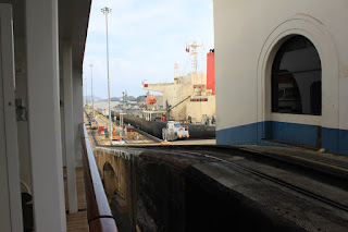
Almost inside the first lock now and gate will be closing behind us.  Not much room on either side of the ship.
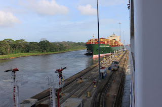
 A container ship entering the lane next to us.  There are two lanes in use 24 hours a day, 365 days a year.  The new larger lane will be opening in a few months, April I believe.
The lock gates each weigh 662 tons mounted on 17 ton hinges.  They are perfectly balanced as it only takes two 25 horse power hydraulic motors to open and close them.  The gates are overhauled every couple of years.
                 This photo shows how the gates are in the stowed position flush to wall.


We are being raised inside the lock as water from the lock above is allowed to enter our lock by gravity through 18 foot diameter tunnels in the center portion of the canal locks.  You can see the water entering lock now raising our ship like a cork.


The 3 Gatun locks on the Atlantic Ocean side of the canal will raise our ship 85 feet up to the Gatun Lake.

The container ship in lane next to us barely fits in the lock.  The locks are 110 feet wide and 1050 feet long.


                                                Photo taken before being raised.
                                             Photo taken after being raised in the lock.


                                                   Gate being closed behind us.
                                            The canal is constantly being dredged.
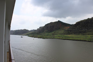
Photos showing the Gaillard Cut.  14,000 tons of explosives were used to blast rock from the Continental Divide.  100 locomotives and 2300 rail cars were used the dirt and rocks dug up by huge steam shovels out of the 10 mile long cut.

Centennial Bridge completed in 2004.  Continental Divide is just prior to bridge.

                                                Approaching the Miraflores Locks
                                                         Entering the locks.


                                         This is the first of the two Miraflores locks.
                             This used to be the US military base that protected the canal.
                                       The next 4 photos show the gate opening sequence.


                                               Gates will fit into the side of the lock.
                       Visitors center where you can view the Miraflores locks operation.
             Miraflores Locks-Consists of two locks that finish lowering us to sea level.
                                                           Canal visitors center
                               Photo taken after being lowered in the first of the two locks.
                            Gates being closed behind us.  Notice the water level on gates.
                                      Gates now closed and we are about to be lowered.
                                         Note water level now on gate after being lowered.
Ship coming into the lock behind us.  I took this from top deck of our ship after we were lowered.
                               Pan American Bridge--connects Central to South America.
                                            Panama City in the background.                                        

                                           Passing under the Pan American Bridge
                                       Port of Balboa on the Pacific Ocean side

No comments:

Post a Comment